New Projects
New trail ideas can come from anywhere – CAMBA members, community input, our team, or even land managers. We’re supported by a mix of paying members, the provincial government, municipalities, grants, partnerships, and donations, each with priorities that we work hard to balance.
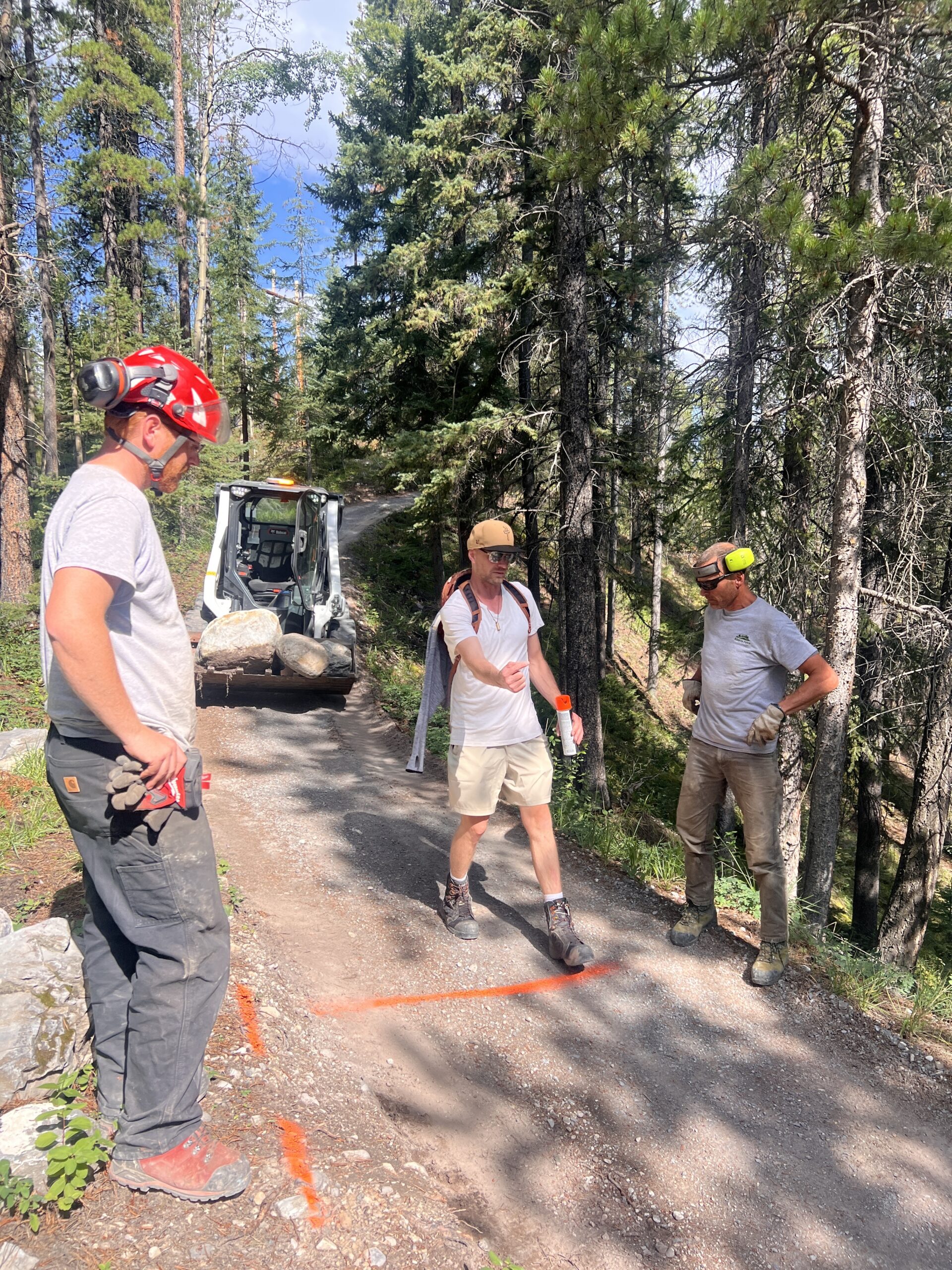
From ideas to shovels in the ground, the approval process can take anywhere from 1 to 2 years to over a decade. This usually starts with a discussion at a CAMBA board meeting. If there’s support, we prepare an initial proposal for the relevant land manager. From there, it’s a multi-step journey – each phase requiring approvals and careful coordination.
For large-scale projects, CAMBA may contract out the development of conceptual plans and detailed designs. We then use a Request for Proposal (RFP) process to select a suitable builder to get the best finished product. Smaller projects or improvements to existing trails are typically managed in-house.
Alberta Forestry and Parks (AFP) provides a detailed guide outlining their application and review process. You can explore it here.
Who pays for trail construction?
Once the concept is approved and no major concerns are raised, we shift focus to funding. Most trail construction costs are covered through external sources, including:
- Government and municipal grants
- Strategic partnerships
- Targeted fundraising efforts
Although CAMBA is fortunate to receive some operational funding from the province and local governments, it doesn’t stretch to cover the cost of new trails.
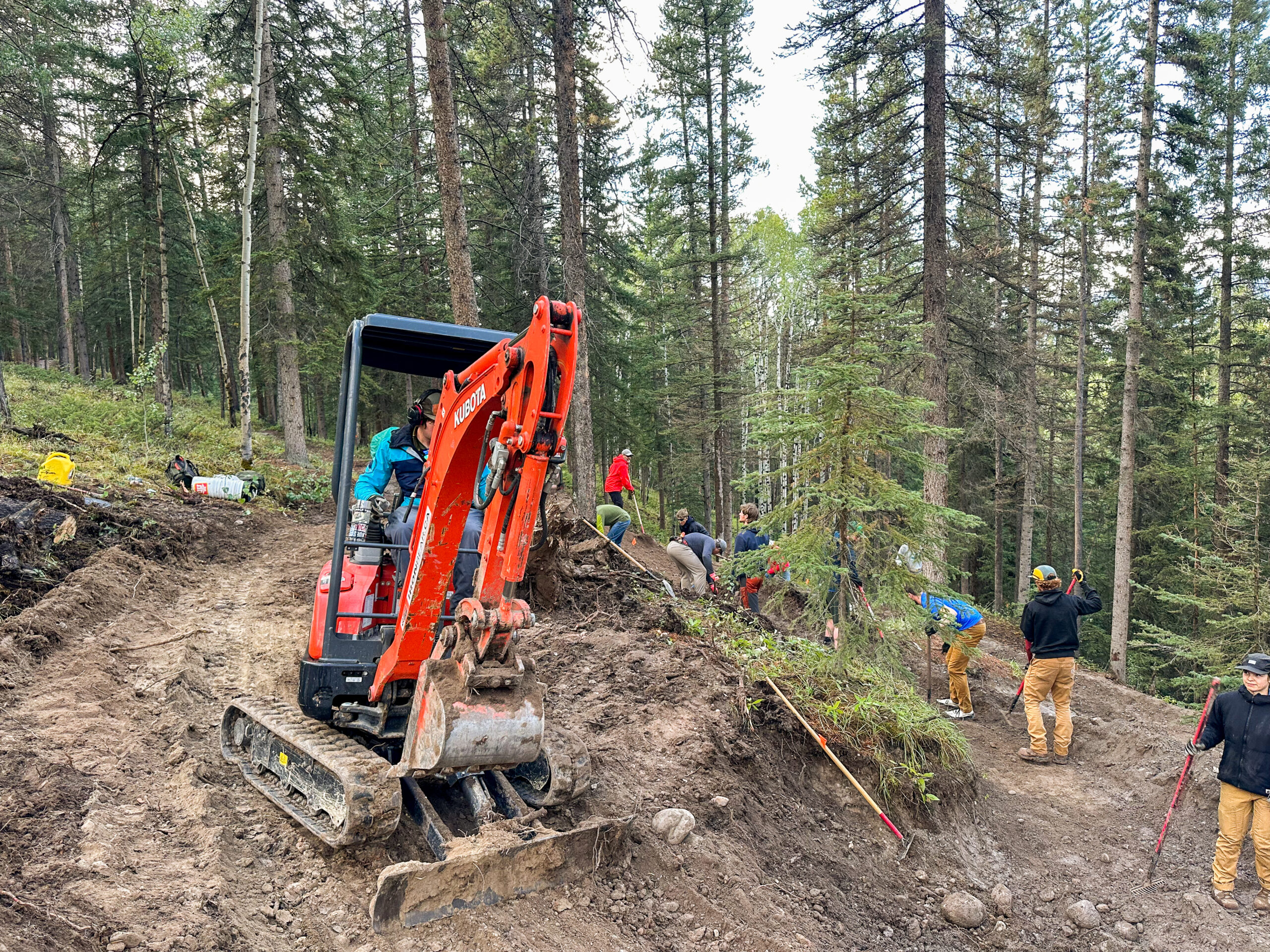
Large-scale projects, especially those built by machines with dirt and wooden features, or those built to an adaptive standard, can easily cost more than $100,000 to construct. As an example, CAMBA’s proposed Powerline Connector trail, which aims to connect the network on the southwest side of the valley, is approximately 3 kilometers long and has a funding goal of $200,000 to bring the project to reality. While hand-building may be the only feasible option in remote areas or for particular trail styles, it diverts our crew from essential seasonal maintenance. By comparison, a single skilled machine operator can accomplish in one hour what it would take ten workers to do by hand.
Why trail project approvals take time
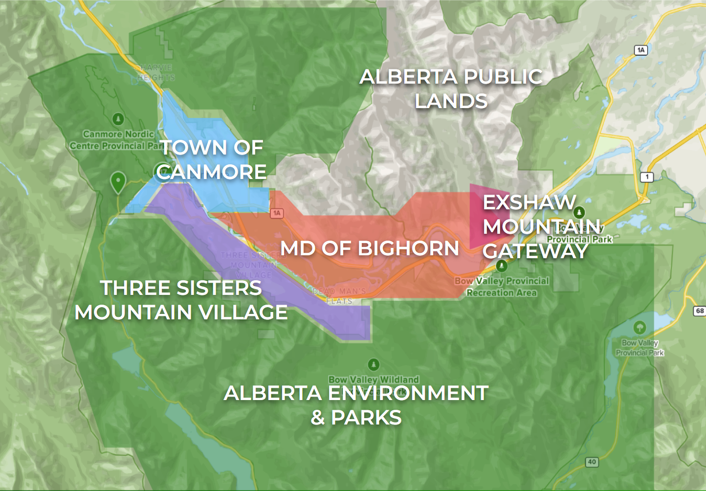
Alberta Provincial Parks are protected land, and they surround Canmore. Any development that disturbs the land, such as cutting trees, crossing creeks, or increasing human use, undergoes a rigorous review process. Land managers weigh the recreational benefits of each project against its potential impacts on wildlife. It’s a thoughtful, case-by-case process. Some areas, particularly wildlife corridors or habitat patches, are unlikely ever to receive approval for additional trail development.
The Town of Canmore, in Southern Alberta, is in Treaty 7 territory. This treaty encompasses the ancestral lands of the Stoney Iyarhe Nakoda (Chiniki, Bearspaw, and Goodstoney Nations), Tsuut’ina, Siksika, Kainai/Blood Tribe, and Piikani Nations. The Métis people of Alberta also share a rich history with this land, coinciding with the European settlement of the area. All trail proposals must respect Indigenous land use and cultural values.
Another consideration? Long-term trail stewardship. All new trails require regular maintenance to ensure they remain safe and sustainable for users. CAMBA, Friends of Kananaskis, and other groups support this effort; however, if that fails, full responsibility for maintaining built trails falls back on the land manager—sometimes for decades or even centuries. Once a trail is built, removing it takes even more resources.
The reality of red tape
Yes, there are hurdles. But they’re there for good reason: to protect this incredible place while making recreation safe and sustainable. Our friends at the Revelstoke Trail Association recently described their lengthy approval process here.
Wherever you are, building a new trail is more than marking a path – it’s building a future with care.
CANMORE AREA TRAILS STRATEGY (CATS)
For decades, trail development in the Bow Valley has suffered from a lack of a trail master plan. The Canmore Area Trails Strategy (CATS) aims to change that. Once finalized, CATS will provide a decision-making framework that streamlines planning and development processes. It’s a necessary response to the growing demand for sustainable recreational trails in Canmore, striking a balance between world-class outdoor access and the vital conservation of local wildlife and habitats.
CAMBA became aware of CATS in 2022. Since then, land managers have paused most new trail projects and significant modifications to existing government-managed trails – including our proposed Powerline Connector. While the wait has been difficult, the long-term impact of this strategy promises to be transformative.
In early 2024, CAMBA joined the advisory group supporting the CATS process. Representing the interests of mountain bikers, trail users, and the broader recreational community, our team has attended multiple meetings, reviewed documents, provided extensive feedback, and invested hundreds of hours. This collaborative effort resulted in the first revision of the strategy, which was released internally earlier this year.
Although the public review was initially expected in spring 2025, it has been delayed. We had hoped to celebrate its release at our AGM in May, but unfortunately, that wasn’t possible. While the government has not confirmed the new timeline, we anticipate public review will occur later this year, with the entire process concluding by early 2026.
We cannot share details of the proposed plans yet, but we’re encouraged by the direction they’re heading. The strategy strikes a meaningful balance between recreational development and environmental protection. Looking at the big picture, some beloved trails may be lost in the process; however, there are exciting plans for mountain bike trails that more than make up for that loss. These are big plans that will take decades to achieve. The ultimate goal is to create an exciting and inclusive trail network of solely designated and maintained trails, striking a fair balance of recreation experience and wildlife and habitat protection. Currently, only a third of trails in the Bow Valley are designated by their land managers, leaving the other two-thirds unmanaged, unmaintained, and unprotected.
To learn more about the Canmore Area Trails Strategy, including background materials and guiding principles, visit the Alberta government website here.
(Note: proposed trails and specific changes are not yet listed.)
We encourage CAMBA members and the broader trail community to provide feedback when the opportunity arises. We’ll let you know when and how to participate.
Highlights for Mountain Bikers
The current draft of CATS spans over 140 pages. Although we cannot share the details yet, here are a few points we believe mountain bikers should be excited about:
- Trail Design Tailored to Mountain Biking
Moving beyond the “all trails are multi-use” model, many new trails will be purpose-built for mountain biking. While some may still accommodate compatible users (e.g., hikers on climbing trails), others will feature multiple trails running parallel to separate traffic, thereby improving safety. - Directional Trails to Improve Flow
Expect more single-directional and preferred-directional trails designed for enhanced flow and safety. - New Terrain for Technical Trails
To mitigate human impact in wildlife corridors, new trails are being proposed on steeper terrain above existing paths, particularly on the south side of the valley. This terrain will suit steeper, more technical trail development specifically designed and built for the modern skills, needs, and wants of mountain bikers. The majority of this will be black-rated or higher. Undesignated trails in sensitive wildlife areas will be phased out.
CAMBA has always advocated strongly for a “same or better” approach to replacing undesignated trails.
- Canmore Nordic Centre Trail Network Improvements
CAMBA has proposed restructuring the existing trails into a mostly directional loop system, including entrance points to marked trail zones (green, blue, black, and enduro) that loop back to the stadium. These are not new ideas. These recommendations, though still under review, have received positive feedback so far. Some trails, such as downhill runs like Top Gun, would be designated for one-way use due to safety concerns. Others would have preferred directions to guide visitors and newer riders more effectively. These designations won’t restrict local riders or race organizers – they’ll simply offer a clearer system for visitors and new riders to understand the network. It has taken most local riders years to figure out how to get the trail experience they want from the Nordic Centre trails.
Our proposal for the CNCPP also includes filling in missing links across the existing trail system.
We hope this overview answers some of your questions and builds excitement for what’s ahead. As plans evolve and new projects are approved, we look forward to discussing and celebrating many new trail projects with you soon.
Want to support CAMBA’s work or pitch a trail idea? Email board@camba.ca to join us at one of our monthly board meetings, generally held every third Monday evening of the month, or drop us a line!